№ 01
№ 01ΠΗΓΕΣ ΑΧΕΡΟΝΤΑ
Γλυκή · χλμ 0
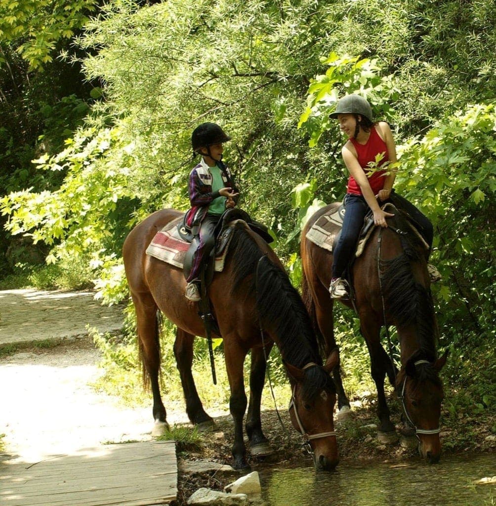
Η αφετηρία. Κρύες, πεντακάθαρες πηγές αναβλύζουν από τη βάση των βράχων. Εδώ ξεκινά κάθε δραστηριότητα ράφτινγκ, καγιάκ και ιππασίας.
Ο ΠοταμόςΠου ΔιέσχισεΟ Οδυσσέας.
Πριν ο Αχέροντας γίνει τόπος για ράφτινγκ, ιππασία και βουτιές, ο Όμηρος τοποθέτησε εδώ τον Οδυσσέα, στην άκρη του κόσμου των ζωντανών. Σήμερα οι ίδιες κρύες πηγές περνούν από τη Γλυκή, ένα πραγματικό χωριό που μπορείτε να γνωρίσετε σε μια μέρα στο ποτάμι.
Με την ταινία «Η Οδύσσεια» του Nolan να έρχεται φέτος το καλοκαίρι στις αίθουσες, το πιο θρυλικό ποτάμι του Κάτω Κόσμου επιστρέφει στο προσκήνιο. Όμως ο Αχέροντας δεν είναι απλώς ένα κινηματογραφικό σκηνικό—είναι μια πραγματικότητα 11°C. Κολυμπήστε στο ασβεστολιθικό φαράγγι, κάντε κουπί στις κρύες πηγές και περπατήστε εκεί που στάθηκε ο Οδυσσέας. Ζήστε τον μύθο εκεί που συνέβη πραγματικά.
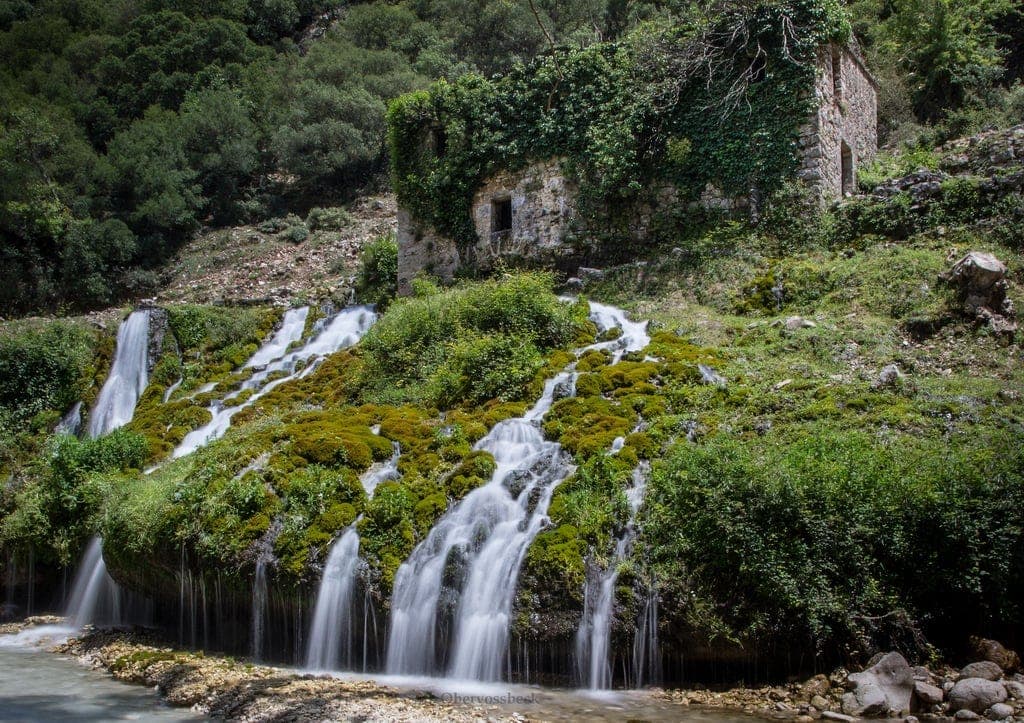
Η Γλυκή πήρε το όνομά της από το γλυκό της νερό. Η παράδοση λέει ότι ο Άγιος Δονάτος σκότωσε έναν δράκο που είχε δηλητηριάσει το ποτάμι, και το νερό έγινε ξανά γλυκό. Η πιο απλή αλήθεια είναι εξίσου όμορφη: εδώ ο Αχέροντας τροφοδοτείται από κρύες πηγές που φιλτράρονται μέσα από ασβεστόλιθο. Στην πηγή, το νερό είναι καθαρό, κρύο και πόσιμο.
 № 01
№ 01Η αφετηρία. Κρύες, πεντακάθαρες πηγές αναβλύζουν από τη βάση των βράχων. Εδώ ξεκινά κάθε δραστηριότητα ράφτινγκ, καγιάκ και ιππασίας.
 № 02
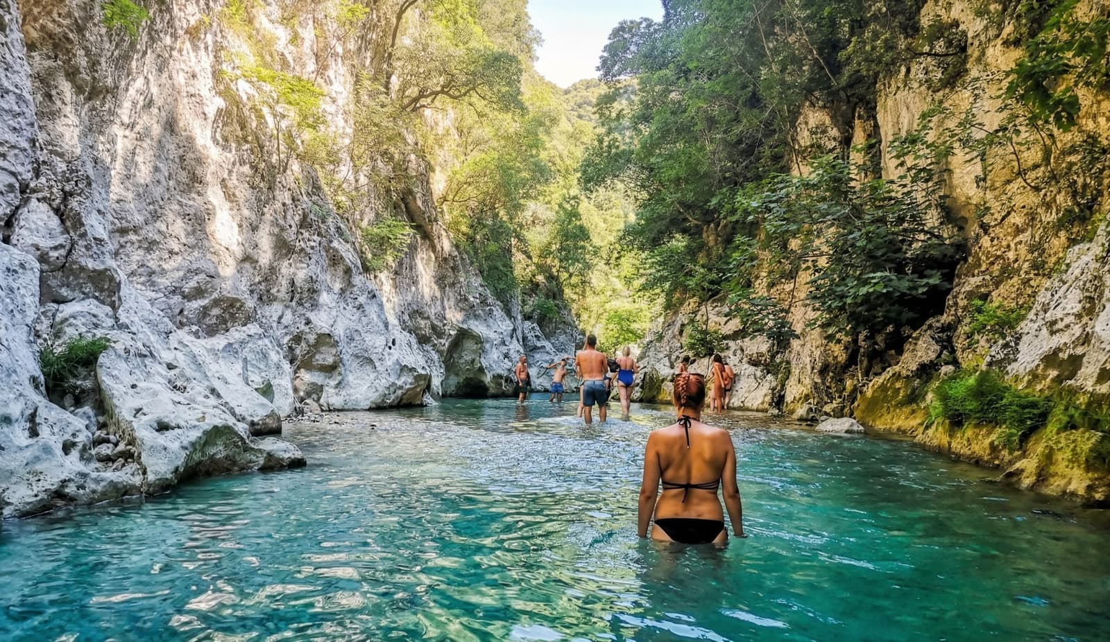
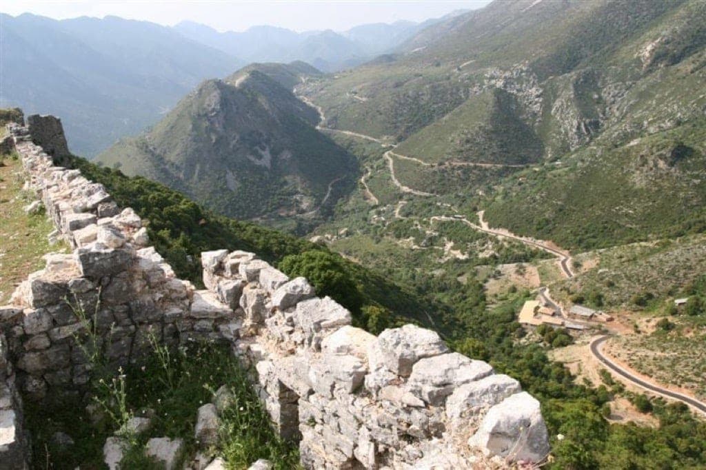
№ 02Στενό φαράγγι όπου τα ασβεστολιθικά τοιχώματα κλείνουν. Το όνομα είναι αρχαίο, αλλά σήμερα είναι μια ήρεμη στάση για κολύμπι και φωτογραφίες.
 № 03
№ 03Τα ορεινά χωριά του Σουλίου, όπως η Κιάφα, η Σαμονίβα και το Αβαρίκο, όπου τοπικές κοινότητες αντιστάθηκαν στους Οθωμανούς τον 18ο αιώνα.
 № 04
№ 04Τα ερείπια του αρχαίου Μαντείου των Νεκρών. Η Νέκυια του Ομήρου, φτιαγμένη από πέτρα. 20 λεπτά οδικώς από τη Γλυκή.
 № 05
№ 05Εκεί όπου ο Αχέροντας φτάνει στο Ιόνιο: μια μεγάλη εκβολή, ένα ψαροχώρι και η παραλία που θα είχε αντικρίσει πρώτος ο Οδυσσέας.
 № 06
№ 06Το «γλυκό» χωριό. Πήρε το όνομά του από τον μύθο του Αγίου Δονάτου που σκότωσε έναν δράκο που είχε δηλητηριάσει τις πηγές, κάνοντας τα νερά ξανά γλυκά.
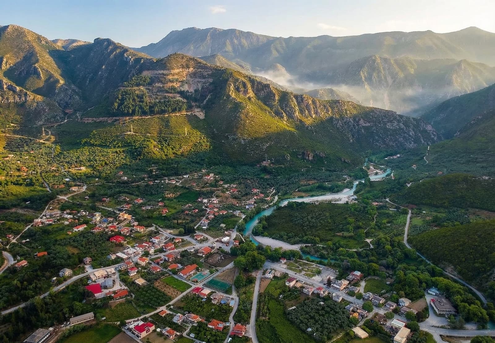
Η παλιά ιστορία ακολουθεί ένα πραγματικό ποτάμι. Η Γλυκή βρίσκεται στις κρύες πηγές, το φαράγγι στενεύει στις Πύλες, και το νερό συνεχίζει δυτικά μέχρι να φτάσει στην Αμμουδιά και τη θάλασσα.
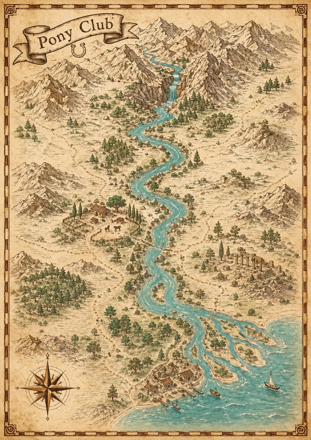
Οι Πηγές Αχέροντα βρίσκονται ακριβώς έξω από τη Γλυκή Θεσπρωτίας, στην Ήπειρο. Το αυτοκίνητο είναι μακράν ο ευκολότερος τρόπος — βάλτε στην πλοήγηση «Γλυκή» ή «Πηγές Αχέροντα» και ακολουθήστε τις καφέ πινακίδες από το χωριό.
Στο τέλος του δρόμου για τις πηγές, ακριβώς πριν το μονοπάτι, υπάρχει δωρεάν δημοτικό πάρκινγκ. Στη διαδρομή θα δείτε και τα πάρκινγκ των επιχειρήσεων δραστηριοτήτων — το δικό μας βρίσκεται στη βάση του Pony Club στη Γλυκή, απ' όπου ξεκινούν όλες οι δραστηριότητες.
Pony Club Acheron, Γλυκή — 2 χλμ πριν την αφετηρία του μονοπατιού των πηγών. Ελάτε οποιαδήποτε ώρα μεταξύ 10:00 και 16:00 την ημέρα της δραστηριότητάς σας.
Οδηγήστε μέχρι τη Γλυκή Θεσπρωτίας και ακολουθήστε τις πινακίδες «Πηγές Αχέροντα» — οι πηγές απέχουν 2 χλμ από το χωριό. Το αυτοκίνητο συνιστάται: τα λεωφορεία προς τη Γλυκή είναι ελάχιστα. Από την Πάργα η διαδρομή είναι περίπου 35 λεπτά, από Πρέβεζα ή Ιωάννινα περίπου 1 ώρα, και από την Ηγουμενίτσα περίπου 50 λεπτά.
Υπάρχει δωρεάν δημοτικό πάρκινγκ στο τέλος του δρόμου των πηγών, ακριβώς πριν το μονοπάτι. Οι επιχειρήσεις δραστηριοτήτων έχουν επίσης δικά τους πάρκινγκ — οι επισκέπτες του Pony Club παρκάρουν στη βάση μας στη Γλυκή, απ' όπου ξεκινούν όλες οι δραστηριότητες.
Ναι — το περπάτημα στις πηγές και στο φαράγγι είναι δωρεάν, καθώς όλο το ποτάμι είναι προστατευόμενη περιοχή Natura 2000. Οι οργανωμένες δραστηριότητες όπως ράφτινγκ, ιππασία και καγιάκ κλείνονται ξεχωριστά, με άμεση online επιβεβαίωση.
Το νερό των πηγών μένει στους 11–15°C όλο τον χρόνο, ακόμα κι όταν η ακτή έχει 35°C τον Αύγουστο. Φέρτε μαγιό, πετσέτα και παπούτσια νερού — για τις οργανωμένες δραστηριότητες παρέχουμε κράνη, σωσίβια και όλο τον εξοπλισμό ασφαλείας.
Περπάτημα μέσα στο ποτάμι, ράφτινγκ (από 10 €), ιππασία δίπλα στο ποτάμι (από 20 € σε πακέτο), καγιάκ (από 15 €) και αυτοκαθοδηγούμενη πεζοπορία στο φαράγγι. Κοντά θα βρείτε το Νεκρομαντείο, τα χωριά του Σουλίου και την Αμμουδιά.
Ο Αχέροντας είναι σπάνιος γιατί ο μύθος, το τοπίο και η καθημερινή ζωή των χωριών παραμένουν στην ίδια κοιλάδα. Μπορείτε να σταθείτε στις πηγές της Γλυκής, να ακολουθήσετε το φαράγγι, να δείτε τα ερείπια του Νεκρομαντείου και να φτάσετε νοερά ως την εκβολή στο Ιόνιο.
Στη ραψωδία λ' της Οδύσσειας, η Κίρκη στέλνει τον Οδυσσέα στην άκρη του γνωστού κόσμου, εκεί όπου συναντιούνται τρία ποτάμια: ο Αχέροντας, ο Πυριφλεγέθων και ο Κωκυτός. Εκεί καλεί τις ψυχές των νεκρών και συναντά τον Τειρεσία, τη μητέρα του Αντίκλεια, τον Αχιλλέα και τον Αγαμέμνονα. Αυτή η σκηνή είναι η Νέκυια, η τελετή της επίκλησης των νεκρών.
«Εκεί συναντιούνται οι δυο βρυχηθμοί του ποταμού, εκεί που ο Πυριφλεγέθων και ο Κωκυτός χύνονται στον βαθύ Αχέροντα»
Σε αντίθεση με μεγάλο μέρος της γεωγραφίας του Ομήρου, αυτή εδώ δείχνει ένα πραγματικό τοπίο. Αρχαίοι συγγραφείς όπως ο Ηρόδοτος, ο Παυσανίας και ο Στράβων τοποθέτησαν την είσοδο του Άδη εδώ στη Θεσπρωτία. Ο Αχέροντας πηγάζει ακόμα κοντά στη Γλυκή, περνά μέσα από το ασβεστολιθικό φαράγγι, συναντά τον Κωκυτό στον κάμπο και εκβάλλει στο Ιόνιο στην Αμμουδιά.
Πέντε χιλιόμετρα μετά τη Γλυκή, σε έναν λόφο πάνω από τη συμβολή των ποταμών, βρίσκονται τα ερείπια του Νεκρομαντείου της Εφύρας. Είναι το μοναδικό γνωστό μαντείο των νεκρών στην ηπειρωτική Ελλάδα. Οι προσκυνητές νήστευαν, περνούσαν από σκοτεινούς διαδρόμους και έμπαιναν σε έναν υπόγειο θάλαμο για να συμβουλευτούν τους νεκρούς. Ο χώρος είναι επισκέψιμος.
Για χιλιάδες χρόνια, ο Αχέροντας ήταν γνωστός κυρίως ως το ποτάμι του Κάτω Κόσμου. Οι ψυχές των πρόσφατα νεκρών έφταναν στις όχθες του, περιμένοντας τον Χάροντα. Το διόδιο ήταν αυστηρό: δύο νομίσματα τοποθετημένα στα μάτια του νεκρού. Όσοι δεν μπορούσαν να πληρώσουν ήταν καταδικασμένοι να περιπλανώνται στις όχθες για πάντα.
Πάνω από το φαράγγι, όπου ο δρόμος ανηφορίζει μέσα στα πεύκα, βρίσκονται τα ερειπωμένα χωριά του Σουλίου. Τον 18ο αιώνα, μια συνομοσπονδία από αγρότες και κτηνοτρόφους έχτισε εδώ τη δική της μικρή δημοκρατία. Για τριάντα χρόνια αντιστάθηκαν στα στρατεύματα του Αλή Πασά των Ιωαννίνων. Όταν η πολιορκία τελικά έκλεισε το 1803, οι γυναίκες του Ζαλόγγου πήραν τα παιδιά τους από το χέρι και χόρεψαν προς τον γκρεμό αντί να παραδοθούν. Ο χορός διδάσκεται ακόμα σε κάθε ελληνικό σχολείο. Τα ερείπια στέκουν ακόμα στην κορυφογραμμή.
Όλες οι δραστηριότητες ξεκινούν από τις Πηγές Αχέροντα στη Γλυκή: ράφτινγκ από 10 €, ιππασία από 20 €, καγιάκ από 15 € και πεζοπορία στο φαράγγι. Κατάλληλες για παιδιά και οικογένειες, με πιστοποιημένους οδηγούς από το 1998.
Ολόκληρη η λεκάνη του Αχέροντα, από τις πηγές μέχρι τη θάλασσα, είναι Ειδική Ζώνη Διατήρησης Natura 2000. Φιλοξενεί αιωνόβια πλατάνια, ενδημικά ψάρια, τις τελευταίες χελώνες Καρέτα-Καρέτα που φωλιάζουν στις ακτές του Ιονίου, και χρυσά τσακάλια στο φαράγγι.